Tropical Cyclones
In our last telephone conversation with Fedor he mentioned the risk of getting caught in one of the cyclones that are predominant in the Oceania between November and April.
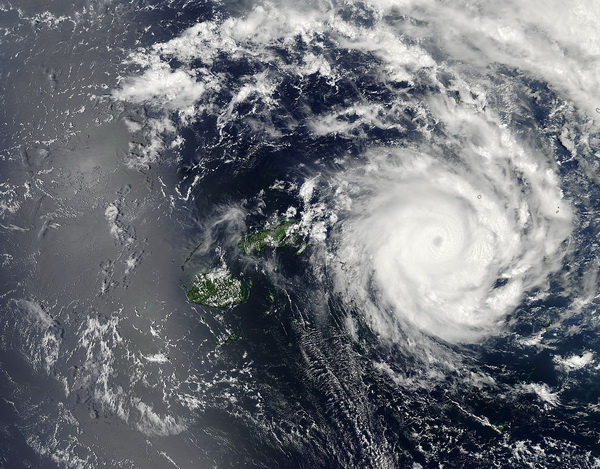
A Pacific Ocean cyclone is analogue with a hurricane in the Atlantic Ocean. If the wind is up to 65 knots it is a tropical storm, but when the wind rises beyond 65 knots (100 km/hrs.) it turns into a cyclone. Such weather conditions are present in every ocean of our planet, they just carry different names: typhoons in the North Pacific Ocean; hurricanes in the Atlantic; and cyclones in the South Pacific and Indian oceans.
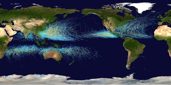
In the South Pacific the cyclones pose a real risk in the area from the Tuamotus archipelago to the east coast of Australia. The second half of Fedor’s transpacific rowing will be in the tropical cyclone zone.
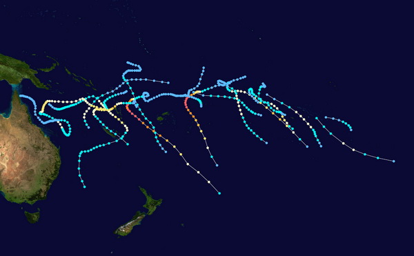
Given the devastating force of cyclones to the population of the Oceania and the coast of Australia the search and rescue forces of these countries monitor closely for low pressure zones which are the birth place of tropical storms. One of the websites that provides the most recent data on tropical storms in the French Polynesia is French CyclonExtreme. According to this website, there was already one cyclone that passed through the area of Fedor’s route. This cyclone was christened as IAN and it battered the South Pacific archipelago with gusts up to 287 kilometers (178 miles) per hour. There were four more tropical storms in the area: June, Dylan, Edna, and Fletcher. The storm Dylan turned into a cyclone and hit the North Queensland coast of Australia. The other three storms had passed in the open ocean from north to south. Based on the weather prognosis for 2013-2014, there will be 4-6 more tropical storms and cyclones in the area.
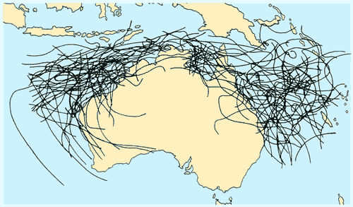
Cyclones gain their strength in the equatorial latitudes where the temperature of the sea-surface is 26.5° or higher. Once a cyclone reaches its full force it can exist in colder latitudes moving chaotically. To accurately predict the trajectory of a cyclone is very difficult. The black lines in the image below show the erratic paths of every cyclone that had plummeted the Australian coasts for the last few decades.
A cyclone is not affected by the ocean breeze and trade winds. The eye wall of a cyclone can reach 15 kilometers in height, connecting the surface of the warm ocean with the stratosphere. It’s vertical form is eventually destroyed after entering land or cold water latitudes where it loses its strength without the warmth of the sea-surface. If a cyclone is 2-3 latitudinal degrees in width than it’s in the small range; 3-6 degrees in width makes it a mid-range; and at 6-8 degrees width it become a large scale cyclone. The average speed of Fedor’s boat is 2-3 knots which is not fast enough to outrun a cyclone. We at headquarters need to keep Fedor informed on the location and trajectory of cyclones in his path. In the case of an imminent tropical storm or cyclone, Fedor would use a sea anchor which acts as a brake in stormy weather and wait for cyclone to pass. Once a sea anchor is released the boat can proceed only due to the current which is about one knot in the tropical storm zone.
Australian Bureau of Meteorology reports that as of February 19th, 2014, there are currently no tropical cyclones.
Project Manager Oscar Konyukhov
Translated by Tatiana Koreski