Day 20
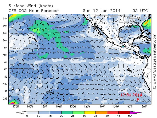
Fedor reports: “Today I crossed 20° Southern Latitude and continue to head north. Despite my desire to turn west I cannot do it just yet. Right now conditions are ideal: downwind of 15 knots with gusts up to 18 knots; the Humboldt Current greatly aides my rowing. However, I’m already thinking about what lies ahead. In about 3 000 nautical miles I will be facing a serious tactical decision – how to approach and pass the French Polynesia.
It is made up of several groups of Polynesian islands such as the Tuamotu Archipelago, the Marquesas Islands , the Tubuai Island group, the Gambier Islands, and of course, Tahiti, the largest and the most famous island in the archipelago of the Society Islands. While the picture of the hundreds of islands and atolls looks beautiful and exotic, for an ocean row boat it means only one thing – a very difficult route. It’s hard to maneuver a rowboat amongst the islands, fighting the tidal currents and coastal winds. An ocean rowboat is not a narrow pirogue which is built to maneuver around and in between the small islands. As much as I admire their beauty I will have to stay away from the islands so not to become their castaway.
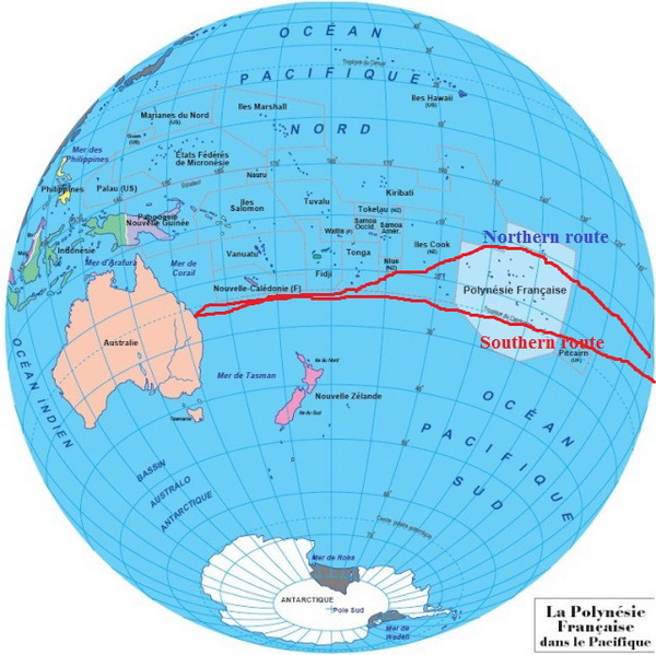
So, I’m facing two different choices as far as rowing through the French Polynesia. The first choice is to pass the islands on the south side, staying within range of the 20° Southern Latitude. However, this poses a risk of being swept off course by the South equatorial Current which will drag me too far south, towards New Zealand. If we add a westerly wind then I would head straight into the Southern Ocean with its ‘Roaring Forties’. This would most likely mean one thing – evacuation- for an ocean rowboat is not designed to withstand such conditions. Option number two is to proceed north to the equator and upon reaching 10° of the Southern Latitude row above the French Polynesia. This approach adds quite a few miles to my crossing but eliminates the risk of being pushed towards New Zealand. I’m voting for the second option and will arch the French Polynesia from the northern side.
My main goal for the next couple of months is to reach waypoint at 12°00′ South Latitude and 140°00′ of West Longitude. This coordinates are located right in between the Marquesas Islands and the Tuamotu Archipelago. Once I pass in-between these groups of islands I will head south-west towards Brisbane, leaving the Cook Islands, Tonga, Fiji and New Caledonia at the starboard. I have about 3200 nautical miles to reach 12°00’S 140° 00′ W. With God’s help, your prayers, and favorable weather conditions I shall be there in about two months. I’m with you. Fedor.”
The map of the Tourgoyak’s course: http://yb.tl/konyukhov2
The detailed map of the course: www.oceanrowing.com/Konyukhov/Pacific2013/dist_map.htm